
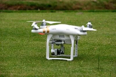
Aerial drones have become very famous, changing how we get beautiful pictures and see the world from above. The fact that these high-tech gadgets can fly at different heights makes them fun for both pros and amateurs. Understanding the types of altitude drones can fly and shoot from is crucial if you want to film beautiful scenery or conduct surveys in remote locations.
This guide will take you on an exciting flight through the sky, showing you what drones can do at different heights and the unique pictures they can take. Get ready to learn about the interesting world of drone photos!
What is Altitude?
The word “altitude” means how high something is above a certain point, usually sea level. It is very important in many areas, such as flight, weather, and even photography. In the case of drones, altitude tells you how high the drone can fly, which is important for safety and usefulness.
Most drones have a barometer built in, which keeps track of and shows the drone’s current position while it’s in the air. This feature is very important for pilots to keep the best flying conditions, stay clear of objects, and follow airport rules. Understanding altitude may also improve overhead images by revealing distinct ground elements from different heights.
Types of Altitudes Drones Can Fly
Different levels give drones different benefits and uses, so they are made to work in a lot of different situations. Understanding these levels of altitude is important if you want to get the most out of your drone, whether you’re using it for filming, mapping, or fun.
We will talk about the different heights that drones can fly at in this part, including what they are used for and the beautiful photos that can be taken from them.
Absolute Altitude
The height of you above sea level is your exact height. You can say this in feet or meters. Once you match the drone’s height in the air to where it took off, you can get a good idea of how high it is.
Pilots, air traffic controllers, and people who run drones all need to be able to fly at this height. They can’t hit other planes or things while they’re in the air without it.
You need to know a lot about the area as well as numbers to get a good idea of the height. Pilots need to know things like how high the ground is below them.
There may be big changes in this in places with lots of hills. Workers should always check their level in relation to the rest of the area because changes in height can make safety rules and directions less useful.
To plan flights and meet government laws, you must know the level. Following height legal altitude limit for each location keeps everyone safe in a crowded airspace. Knowing the height makes it easy to follow these regulations.
Flying in regions with frequent weather changes makes it even more crucial to know your location. They may shift flight trajectories to avoid dangerous individuals, buildings, and other obstacles. You must know absolute height to fly properly and navigate many situations.
Relative Altitude (AGL)
Above ground level (AGL), which is another name for relative altitude, is a very important number that shows how high a drone is compared to the ground. This number is important because it helps pilots figure out where their drone is in relation to the ground or any objects that might be there. AGL is usually shown on a drone’s screen or controller so pilots can keep an eye on things while the drone is in the air.
Learning about AGL is an important part of flying safely because it helps you avoid hitting trees, buildings, and other possible dangers. Also, flight officials often set rules that AGL altitudes can’t go above 400 feet.
This is to keep the sky safe and reduce the chance of interfering with manned aircraft. Not only is it required by law to keep track of AGL, but it’s also a good idea that makes flying more fun and safer for the drone driver.
Density Altitude
If the temperature changes in a way that isn’t standard, the density altitude takes that into account. This is a big part of what makes an airplane work well. People who fly drones need to know about density level because it has a direct effect on how well the drone can fly.
When it’s hot or up high, there are a lot of people in the air, which makes it harder for pilots to stay calm and in control. This is because they can’t turn as well and have less lift.
But low density altitudes, which are often found in cooler areas or at lower elevations, are great for flying because they let drones fly faster and with more lift. When the weather changes, these changes can help you plan trips and make sure that activities are still safe.
Types of Shots at Different Altitudes
The altitude at which a drone flies can significantly impact the type of shots that can be captured. Here are some examples:
Low Altitude (0-50 feet)
At low altitudes, you can get very close to people, buildings, and landscapes and take very detailed shots of them. There are colors and features that are hard to see from higher up that shooters can see up close.
They can also use their pictures to show how they feel and tell stories. When taking pictures of a busy city, for example, low-level flying can show how busy the streets are in a way that pictures taken from the ground can’t.
Also, when you fly lower, you are less likely to be affected by wind or other outside forces, which can be very annoying when you fly higher. Because of this, every picture is better and sharper, and photographers can get beautiful pictures of people that really show what they’re like. Basically, flying at low altitude is a great way to improve photography because it lets people see things from different angles that make art and stories more interesting.
Medium Altitude (50-400 feet)
On trips that are about normal height, you can get great pictures of wide views, sweeping panoramas, and scenes that really show how beautiful a place is. From 200 to 400 feet is a good long-range inspections for both getting close to things, like how rough the land is, and seeing more of the area, like how big towns or nature are.
That’s the highest point most drones can fly, so you can be creative and still follow the rules. People who want to make visually stunning stories that keep people interested and show off the details of their themes often choose trips that are in the middle of the range. From a middle height, you can get some great shots, like a sunset over a mountain range or the busy streets of a city.
High Altitude (400+ feet)
When people fly high, they see the world below in a way that no one else can. The intricate designs of the landscape and the vastness of nature amaze them.
When you fly this way, you can see beautiful views of big mountains, curving coastlines, and towns that stretch out for miles. It’s tough to get a good picture of the scene from the ground.
But it’s important to remember that if you want to fly at very high altitudes, you may need special permission from flight officials. This is to make sure that you stay safe and follow the rules.
Also, flying at such high levels can make it more likely that wind or other bad weather that you can’t plan for will arise and make the trip less stable. If you want to have a safe and fun ride, you need to plan ahead and pay attention to the weather.
Tips for Safe and Successful Altitude Flight and Photography
To enhance your drone flying experience and capture stunning aerial imagery, consider the following tips. Ensuring safety is essential while enjoying your time in the sky.
Pre-Flight Planning
It is important to plan ahead before taking to the air. First, look at the weather. It can really change how your flight goes.
Airspace rules are very important to know, so find out about any rules that might affect what you can do. This helps you stay safe and in line while you fly.
Find out more about the area you want to fly in to get ready. Look over maps carefully to find things that could be dangerous, like power lines, trees, buildings, and other things that might not be clear at first. Being aware of what’s going on around you can help you stay safe and have a better ride.
Also, it’s important to check your drone often to keep it safe. Make sure it works by making sure the batteries are fully charged and the devices are set up correctly. If you do a check before the flight, something less likely will go wrong in the middle of the trip.
Maintain Line of Sight
For safety and control, you must keep a line of sight with your drone while it’s in the air. Keeping a clear view of your drone lets you better judge its location, height, and surroundings, which helps you avoid things that might get in the way. It’s harder to control the drone if you can’t see it, which makes accidents or crashes more likely.
In addition, some rules may say that you need a clear line of sight, so you should always know where your drone is. Making sure you can see your drone will help you handle any unexpected events better and keep you safe while flying.
To get the most out of your flight experience, always put safety first and follow the rules. Keeping your drone in sight is an important part of operating a drone safely, whether you’re an amateur or an expert.
Monitor Altitude and Environmental Conditions
Frequently check the level of your drone and the weather in the area. It’s important to know where you are in order to take good shots and follow the rules about how high you can be. It’s important to follow the rules while you enjoy the view.
Thoughts should also be given to things in the area that might affect flight, like the wind speed, the temperature, and the view. Batteries may not last as long in very cold or very warm weather, and strong winds may make it hard to fly.
Because of these things, you need to change your flight plan to make sure your flight is safe and good. Paying attention and getting used to your surroundings will keep you safer and help you take better pictures.
Use Intelligent Flight Modes
There are many clever flight modes on modern drones that can help you take beautiful pictures while staying safe. Waypoints, Follow Me, and Circle modes let you focus on setting up your shots without having to worry about controlling the drone’s direction by hand. These styles can help you be more creative while also making it less likely that something will go wrong when you’re doing complicated moves.
Post-Flight Data Review
After you’re done with your flight and taking pictures, look over the info you came across. Go through the flight routes, altitude logs, and any warnings the drone may have given you during the trip. This review process can help you figure out how to make your flying and shooting better, so that each flight after this one is safer and more successful than the last.
When seeking a versatile drone that excels across various altitudes, consider DJI Neo for its advanced features and reliability. This model provides impressive stability and camera capabilities, making it an excellent choice for both professional and recreational aerial photography.
Unlocking Creative Potential: Mastering the Types of Altitude in Drone Photography
As you can see, the types of altitude drones can fly at significantly impact the shots you can capture. From close-up details to sweeping panoramas, understanding the capabilities and limitations of each altitude tier is crucial for maximizing your drone’s potential.
So next time you take flight, remember this guide and use your newfound knowledge to unlock endless creative possibilities with aerial photography! Happy flying!
For more tips, tricks, and insights on drone photography and flying techniques, be sure to visit our blog. Discover new ways to elevate your aerial shots and stay updated on the latest trends in the world of drones!